Are you an adventure seeker? If so, you may love trekking in Vietnam. The country offers excellent trekking with remarkable sceneries. And, you may get an unforgettable trip with the images of soaring limestone mountains, tiers of rice fields and plunging highland valleys, etc. Read on this quick guide about the best places for hiking in Vietnam!
Best places to go in Vietnam :
- Ta Nang – Phan Dung
- Ta Lien Son, Lai Chau
- Lao Than Mountain
- Lung Cung
- Fansipan (Lao Cai)
- Hang En
- Yen Tu
- Lang Biang
- Hiking through the forest and spending the night in an ethnic village (Sapa)
- What to wear hiking in Vietnam (There are many great mountains in Vietnam for hiking and trekking . If you plan to go on a hiking trip, besides basic clothes like T-shirts, long pants, jackets, and hiking shoes, remember to bring along protection pads, a pair of sandals, sunglasses, anti-blister socks, and a raincoat.)
- What to Wear in Vietnam - Different Activities
Ta Nang – Phan Dung
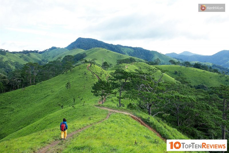
Ta Nang - Phan Dung is a road more than 50 km long in the territory of Lam Dong, Ninh Thuan, and Binh Thuan. Diverse vegetation, majestic scenery, moderate difficulty make this route suitable for trekking of many ages.
Ta Nang side is a beautiful road. Trees grow on both sides of the road, and the slope is not too high. As for Phan Dung (towards Yavly waterfall) is quite slippery, zigzag, has many slopes, and the trees are mainly pine. At the top of Ta Nang, in the evening, the dew falls quite thick and fast. The wind is extreme in the middle of the night.
Ta Lien Son, Lai Chau
Ta Lien mountain (also known as Co Trau mountain) belongs to Ta Leng commune, Tam Duong district, Lai Chau. The hill has an altitude of 2,993 m above sea level, with majestic mountain scenery and ancient forest vegetation.
According to backpacker Hachi8, you need three days and two nights to climb the Ta Lien peak. At noon on day one started climbing. The road is entirely the path that the villagers often go to the forest. You can spend the night in a cave that forest people often climb because there are almost no camps on the road. It would be best if you found a flat resting spot near a water source before dark.
Lao Than Mountain
Lao Than Mountain is known as the roof of Y Ty, located at an altitude of 2,862m, in the territory of Phin Ho commune, Bat Xa district, Lao Cai province. Lao Than - Y Ty is very popular with locals, and they often call it when it comes to the sharp peak of the mountain, standing in the middle of the sky.
The top of Lao Than mountain is a perfect blend of clouds, mountains, and heaven, but unlike Fansipan that requires time and energy, Lao Than is considered a mountain that anyone can set foot on.
Lung Cung
Lung Cung Peak is named after a village located deep in the most rugged mountains in Nam Co commune, Mu Cang Chai district, Yen Bai. This mountain takes about two days and one night in the forest to reach the top and down.
There are three different directions to climb: Thao Chua Chai, Lung Cung, or Tu San. You will go through the ancient forest with stunning scenery. You will encounter unique vegetation or maple foliage.
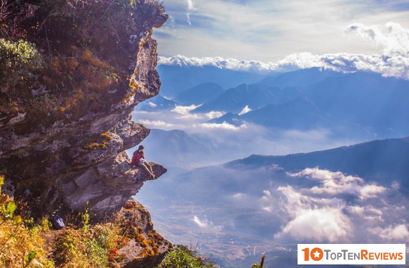
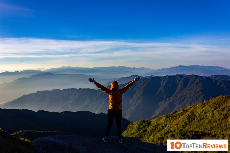
Fansipan (Lao Cai)
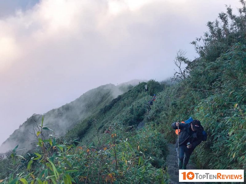
Fansipan is the highest mountain in Vietnam and Indochina and is considered by most backpackers as a goal in their trips. With an altitude of 3,143 m, you can conquer the mountain by three different routes. The easiest way is to start from the Tram Ton to the top and also return this way. The duration of the trip is 2-3 days.
The second way lasts about four days with a length of 19.5 km, starting from the "back" of the Hoang Lien range. Also beginning from Tram Ton, but the way back follows Muong Hoa valley, Cat Cat stream and goes along the east slope of Hoang Lien range.
The third road is more difficult when starting from Doc Mit, Binh Lu to the top. This is a difficult journey, and only professional climbers with complete equipment dare to go.
Hang En
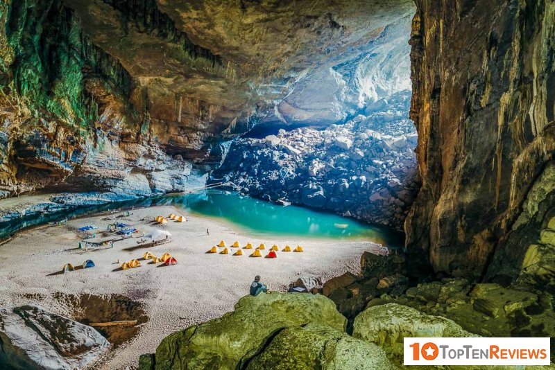
In the past year, Son Doong, Tu Lan, or Hang En are exciting names. Hang En is the third largest cave in the world, with a rich and unique ecosystem. Many adventurous people who have not registered for the Son Doong tour can choose this place to conquer.
From Dong Hoi city, you follow the Ho Chi Minh road west branch to km 35. The distance from km 35 to En cave is about 8 km long. The road has many steep sections, passing through Rao Thuong stream, passing Doong village, a small village of Van Kieu people located deep in the core zone of Phong Nha - Ke Bang national park. Going deeper into the cave, you will once again admire the Rao Thuong stream winding in the shape of an S. The further you go inside; you will observe stalactites of different shapes or swallow's nests.
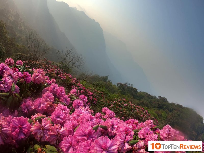
Yen Tu
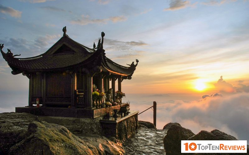
Yen Tu is remembered in the hearts of Vietnamese people not only as a high mountain peak in the Northeast region but also as the origin of Buddhist stories. So the Yen Tu trekking journey in early spring is no longer about conquering, satisfying passion, but going to the sacred land to feel religion and life fully.
The road to Yen Tu is nearly 6000m long from the foot of the mountain to the top, and along the way, people have to overcome thousands of stone steps and steep rocky slopes, sometimes encountering slippery roads, they have to use a cane to keep balance. But that doesn't seem to discourage the pilgrims. They go with a sincere heart and a strong belief in the protection of the gods.
And every step of the way, we can admire the lyrical nature of spring. Somewhere, there is a gentle murmuring stream, ancient trees with more than 700 years old, covered with a layer of green moss, like an older man sitting quietly in the middle of the mountains. Somewhere, there are soaring bamboo forests mixed with the pure white of apricot flowers. Paint a colorful spring picture and subtly the mysterious and wild style of sacred land.
Lang Biang
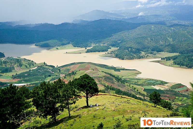
People call Lang Biang the roof of Lam Vien plateau, which marks a romantic love story that still compares it to the love history of Vietnam. So many people choose Lang Biang as a trekking destination to conquer at the beginning of the new year, to breathe in the fresh air in the highlands, and feel more clearly the breadth of great love hidden in the heartbeat of the great thousand.
Lang Biang's trekking journey is not too tricky; even amateurs can reach the top of the mountain after only 3-4 hours of walking. The gentle slopes, nature, and the sky are blooming in spring are indescribable. When you set foot on the misty Lang Biang peak, you will see the majestic nature appearing insight and far away is Da Lat city dreaming in the early morning smoke, noticing the winding roads highland place, so beautiful to the heart.
Hiking through the forest and spending the night in an ethnic village (Sapa)
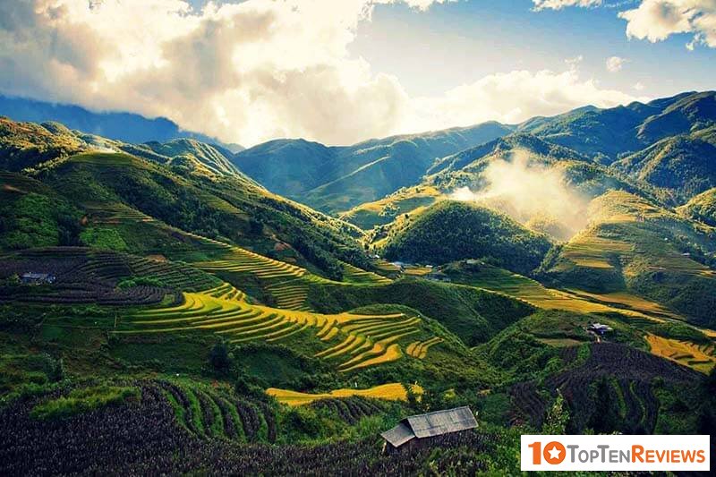
People tell each other that, if you want to learn about Sapa, you should do a trekking tour (walking through the forest) into the village, spend the night in the town and visit the real life of the Mong, Dao, and Day people. The nearest, cheapest, and shortest day tour is Ta Van for two days and one night. More extended day and farther is Ta Phin tour three days two nights sleeping in the village. What's more interesting is the combined Ta Van - Ta Phin tour, you go through from Ta Van to Ta Phin 5 days four nights. You will roam through the rice fields that are sucking the fragrant milk of the whole valley, through the bamboo forest, rowing passes, crossing mountains, wading streams.
Small tip: Buy a tour at your hotel, mid-range hotels in Sapa, and above all, have a service to sell trekking tours for tourists. Each team of each hotel has a local tourist guide, mostly Hmong and girls.